Information:
Online Enquiry
Activities:

Saddle Island
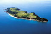
Saddle Island is another one of the Hauraki Gulfs stunning small Islands, with a beautiful long sandy beach on the North West side over looking the entrance to Mahurangi Estuary and several other mainland beaches. Named after Te Haupa, an important Ngati Paoa chief, this small island has a small reef system on the North East corner that can produce some great fishing when the tide is right. Saddle Island is home to several bird species including, shearwaters that nest very close to the beach.
Kawau Island
Kawau Island is one of the most Historic and larger Islands in the Hauraki Gulf. It lies 12 kilometers from our launch location. Kawau island is approximately 8 km long and 5 km wide and is a popular holiday resort for Kiwis and overseas visitors. The Bon Accord Harbour runs nearly 3km in to Kawau Island, almost splitting the Island in two.
Originally purchased in 1837 from Maori, the Island was excessively mined for its deposits of manganese and copper. The remains of several mines are still accessible from one of the walking track that start at Mansion House Bay,
After mining the Island was transformed into a botanical and zoological park, and a wide variety of exotic and subtropical plants and animals where brought on to the Island, some of which are still evident today. Mansion house is now owned and maintained by the Department of Conservation and has been fully restored to its former glory and for a small fee visitors are welcome to take a tour around the house.
Tiritiri Matangi Island
Tiritiri Matangi Islands only a 20 minute boat ride from our launch location and less than 10 minutes with one of our jet skis, the Island is one of the Hauraki Gulfs most successful conservation project and is open to the public all year round. There are 5 main walking tracks on the Island and several of them pass through Hobbs bay, which would be your preferred landing location.
Tiritiri Matangi Island is 218 hectares in area and is home to the oldest lighthouse in the Hauraki Gulf which has been restored and upgraded, and is now boast the brightest beam in the Southern hemisphere.
Motuora Island
Motuora Island is only 8 kilometers from our launch location on the Whangaparaoa Peninsula, and is undergoing a major community-driven restoration project. On the North West side on the Island there is a beautiful long sandy beach with several secluded picnic spots and stunningly clear blue waters. Motuora Island also has a large camp ground and a small hut that can be hired all year round.
Motuora Island is a safe haven for several different species, but in particular the Kiwi Bird, there are no rats, mustelids (stoats, ferrets or weasels) or feral cats on the Islands and wild Kiwis are brought to the Island until they grow to a size where they can defend themselves and then be returned to the wild.
Beehive Island
Beehive Island is one of the smallest and most picturesque Islands in the Hauraki Gulf. From a boat or a jet ski the Island resembles a small tropical island. A reef system of rocks and kelp surrounding the Island and are visible at low tide. At high tide all the rocks disappear and you're left with a beautiful sandy beach with several pine trees in the center. A good area for snorkeling with the surrounding reef and boat access is best from the North side of the Island.
Moturekareka Island
Moturekareka Island is one of the Hauraki Gulfs smaller Islands and lies approximately 10 kilometers from our launch location. Moturekareka sits next to Motuketekete Islands and the two Islands are separated by the Blanche Channel, the Rewa shipwreck can be found on the North Western side of the Island and there's a small sheltered bay behind the wreck. The Rewa shipwreck was the largest four masted steel barque of its time and is half submerged.
Rangitoto Island
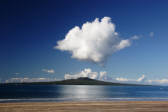
One of the youngest islands in the Hauraki Gulf, Rangitoto is visible from a large area of mainland from South Auckland and all the way up to the Whangaparaoa Peninsula, on a clear day you can also see Rangitoto Island from the Coromandel Peninsula. A series of volcanic eruptions brought the Island out of the waters of the Hauraki Gulf around 700 years ago and rising to an estimated height of 260 meters it is a prominent figure from Aucklands CBD and the surrounding Islands.
Rangitoto Islands land mass is 2311 hectares making it one of the Hauraki Gulfs larger Islands, with a volcanic landscape that is home to the largest Pohutukawa forest on the planet. In the early 1900s Rangitoto Island was mined for over 30 years for it's volcanic scoria and in the 1930s prison labour built roads on the island and a track to the summit that is still used today.
There are several walking tracks on the island and if you have the energy to reach the summit there are stunning views of Aucklands CBD and some of the other Islands of the Hauraki Gulf.
Hauraki Gulf Islands
The Hauraki Gulf Islands and a brief description of some of the more popular Islands you can visit with our jet ski hire, boat hire and Island safari options.
Hauraki Adventure Hauraki Gulf Islands Page
Information
Other Pages
Activities

Contact Us


